TRAVEL AT EASE
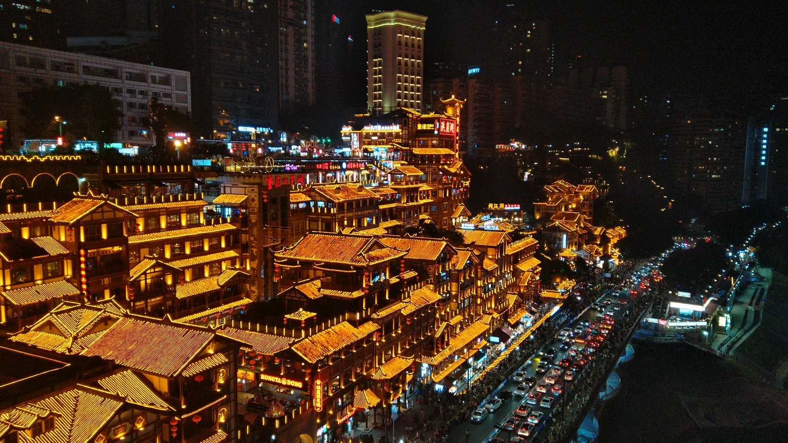
Chongqing’s landscape seems to unfold upwards. Beyond the broad river surface rise slopes, bridges and stacked buildings. Read the city in three dimensions and its turns begin to make sense. Behind the night skyline lies a texture shaped by water and the people living alongside it.
People arriving by water
Chaotianmen stands where the Yangtze and Jialing meet. River transport once made it an important gateway to the city. Municipal place-name histories describe porters, traders and people passing between wharf and city gate. With that history in mind, a lane becomes more than an approach to a viewpoint: it belongs to the exchange of goods and the gathering of urban life.
Bring your gaze back from the skyline to the street. Between high roads and low riverbanks, stairs, corners and landings continually change the scale of a walk. Time spent in a public space, listening to conversation and watching people pass, reveals how a demanding terrain becomes an ordinary place to live.
Different buildings, different answers to the slope
Hongyadong is a modern complex drawing on traditional stilt-house forms. Its riverside height difference becomes a series of levels. A distant view reveals how the buildings gather against the slope; a closer look connects entrances with roads. Lighting sharpens the outline, while the relationship between hillside, riverbank and building gives the place its spatial character.
Shancheng Lane offers a different set of layers. The municipal housing authority records old city-wall remains, the former Ren’ai Hall and buildings from different periods. Renewal brings these fragments into present-day use. Following the meeting of walls, steps and houses can reveal more than treating every old street as the same nostalgic setting.
A peninsula shaped by two rivers
The Yangtze and Jialing converge at Chaotianmen and embrace the Yuzhong peninsula, whose ground rises towards the west. Rivers define its edges; hills give roads and buildings a vertical dimension. Here, closeness involves more than distance on a flat map: a street’s level and its connection to the waterfront matter too.
The riverbanks are also spaces for public life. Waterside places bring people close to the river, while bridges and buildings carry the view across to the opposite shore. Daylight reveals how districts follow the slopes; evening lights bring out another set of layers. River colours can change, but the relationship between mountain, water and city remains rewarding to trace.
Return to street level with a bowl of xiaomian
Chongqing noodles bring several seasonings together: chilli oil, Sichuan pepper, peanuts or pork fat may be involved, with variations between preparations. Notice how aroma, noodle texture and seasoning meet, then talk about the flavours you enjoy. An everyday meal offers another introduction to the city.
One place, two scales
Look across a riverside group of buildings, then notice how one stairway joins a street. The first reveals the city’s outline; the second shows how it is used. Together, they give the night view a background of daytime life.
The rivers connect Chongqing to distant places; its slopes and lanes bring the city close.
Sources and photography
Jonashtand / Wikimedia Commons · Photo source · CC BY-SA 4.0